Loading...
Searching...
No Matches
Kartographer\Tag\MapTagArgumentValidator Class Reference
Validator and preprocessor for all arguments that can be used in <mapframe> and <maplink> tags. More...
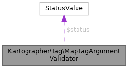
 Collaboration diagram for Kartographer\Tag\MapTagArgumentValidator:
Public Member Functions | |
| __construct (string $tag, array $args, Config $config, Language $defaultLanguage, LanguageNameUtils $languageCodeValidator=null) | |
| hasCoordinates () | |
| usesAutoPosition () | |
| getLanguageCodeWithDefaultFallback () | |
| setFirstMarkerProperties (?string $fallbackText, stdClass $properties) | |
| getTextWithFallback () | |
Detailed Description
Validator and preprocessor for all arguments that can be used in <mapframe> and <maplink> tags.
As of now this class intentionally knows everything about both tags.
@license MIT
Constructor & Destructor Documentation
◆ __construct()
| Kartographer\Tag\MapTagArgumentValidator::__construct | ( | string | $tag, |
| array | $args, | ||
| Config | $config, | ||
| Language | $defaultLanguage, | ||
| LanguageNameUtils | $languageCodeValidator = null ) |
- Parameters
-
string $tag Tag name, e.g. "maplink" array<string,string> $args Config $config Language $defaultLanguage LanguageNameUtils | null $languageCodeValidator
Member Function Documentation
◆ hasCoordinates()
| Kartographer\Tag\MapTagArgumentValidator::hasCoordinates | ( | ) |
- Returns
- bool If a complete pair of coordinates is given, e.g. to render a <maplink> label
◆ usesAutoPosition()
| Kartographer\Tag\MapTagArgumentValidator::usesAutoPosition | ( | ) |
- Returns
- bool If the map relies on Kartotherian's auto-position feature (extracting a bounding box from the GeoJSON) instead of the arguments alone (coordinates and zoom)
The documentation for this class was generated from the following file:
- includes/Tag/MapTagArgumentValidator.php
